
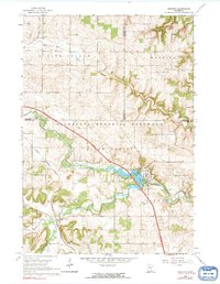
1965 Map of Oronoco
USGS Topo · Published 1967About this map
Oronoco sits at the heart of this mid-1960s landscape, positioned where the Middle Fork Zumbro River widens into the waters of Shady Lake. The area is defined by the convergence of several waterways, including Dry Run, Pine Island Creek, and the South Branch Middle Fork Zumbro River, which carve through the Minnesota Memorial Hardwood State Forest. This survey captures the transition of the local economy and infrastructure, showing the Chicago Great Western railroad line cutting diagonally across the terrain, passing through the township of New Haven.
Find a feature on this map
25 named features on this map. Tap any name to fly to it.
Don’t see what you’re looking for? This feature index may not catch every label — zoom into the map to look around manually.
Map Details
Editions of this 1965 Oronoco Map
2 editions found
Other maps of this area

1935 · Rochester
USGS Topo · 1:48,000

1939 · Rochester
USGS Topo · 1:62,500

1951 · Lake City
USGS Topo · 1:62,500

1953 · Saint Paul
USGS Topo · 1:250,000

1959 · Saint Paul
USGS Topo · 1:250,000

1965 · Byron
USGS Topo · 1:24,000

1965 · Pine Island
USGS Topo · 1:24,000

1966 · Douglas
USGS Topo · 1:24,000

1968 · Zumbrota
USGS Topo · 1:24,000

1968 · Mazeppa
USGS Topo · 1:24,000