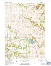
1965 Map of Oronoco
USGS Topo · Published 1991About this map
Oronoco stands at the confluence of the Middle Fork Zumbro River and its southern branch, a landscape defined by the impoundment of Shady Lake. The mid-1960s terrain shows a village tightly integrated with the local river system and protected by Oronoco State Park. Beyond the town center, the Minnesota Memorial Hardwood State Forest covers the steep, wooded bluffs that flank the river valleys. Transport and commerce are evidenced by the path of the Chicago Great Western railroad, which cuts through the southern agricultural lands and the township of New Haven. Rural life is anchored by landmarks like St Peters Ch and the neighboring Cem in the northern section, while industrial activity is noted at a local Quarry and a Gravel Pit. The map also identifies the Holter Landing Strip near the border of Wabasha and Goodhue counties, highlighting the small-scale aviation of the era.
Find a feature on this map
20 named features on this map. Tap any name to fly to it.
Don’t see what you’re looking for? This feature index may not catch every label — zoom into the map to look around manually.
Map Details
Editions of this 1965 Oronoco Map
2 editions found
Other maps of this area

1935 · Rochester
USGS Topo · 1:48,000

1939 · Rochester
USGS Topo · 1:62,500

1951 · Lake City
USGS Topo · 1:62,500

1953 · Saint Paul
USGS Topo · 1:250,000

1959 · Saint Paul
USGS Topo · 1:250,000

1965 · Oronoco
USGS Topo · 1:24,000

1965 · Byron
USGS Topo · 1:24,000

1965 · Pine Island
USGS Topo · 1:24,000

1966 · Douglas
USGS Topo · 1:24,000

1968 · Zumbrota
USGS Topo · 1:24,000