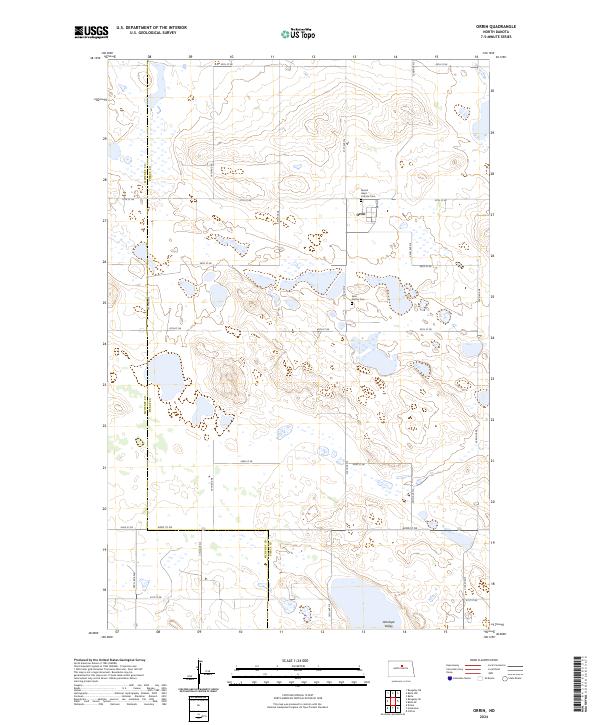
2024 Map of Orrin
USGS Topo · Published 2024About this map
Orrin serves as the central settlement within this North Dakota landscape, situated along the county line where McHenry Co meets Pierce Co. This region is defined by a dense network of wetlands and small water bodies characteristic of the drift prairie, with the broad Antelope Valley reaching into the southern portion of the survey. The community's local history is anchored by the Sacred Heart Catholic Cem near the town site and the Saint Mathis Cem further south. A rigid grid of section roads, including Main St and 47th St NE, provides access to the surrounding agricultural tracts. The map illustrates the persistent pattern of rural life and land use in this part of the state, where small-scale drainage and wetland conservation areas intermingle with established townships.
Find a feature on this map
28 named features on this map. Tap any name to fly to it.
Don’t see what you’re looking for? This feature index may not catch every label — zoom into the map to look around manually.
Map Details
Editions of this 2024 Orrin Map
This is the sole edition of this map. No revisions or reprints were ever made.
Other maps of this area

1930 · Drake
USGS Topo · 1:62,500

1940 · Aylmer
USGS Topo · 1:62,500

1954 · Minot
USGS Topo · 1:250,000

1954 · McClusky
USGS Topo · 1:250,000

1955 · Rangeley NE
USGS Topo · 1:24,000

1957 · Rangeley SE
USGS Topo · 1:24,000

1958 · McClusky
USGS Topo · 1:250,000

1958 · Minot
USGS Topo · 1:250,000
1958 · Anamoose
USGS Topo · 1:24,000

1958 · Balta SE
USGS Topo · 1:24,000