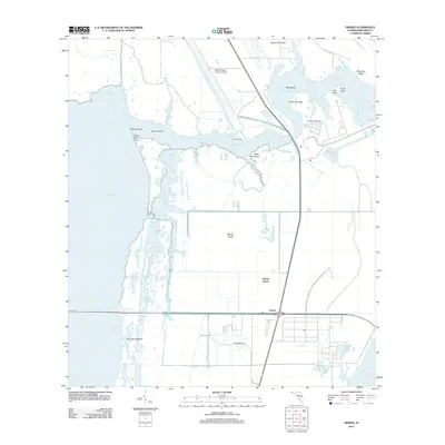
2012 Map of Orsino
USGS Topo · Published 2012About this map
Merritt Island serves as the backdrop for this survey of the northern reaches of the Kennedy Space Center complex, dominated by the massive NASA Shuttle Landing Facility and Launch Complex 39. The landscape is a complex network of waterways, including Banana Cr, Moore Creek, and the tidal marshes of Pine Island Basin. A contrast exists between the advanced aerospace infrastructure and the low-lying terrain characterized by named hammocks and islands such as Cedar Hammock, Skunk Island, and Stony Island. The small settlement of Orsino and Hubs Landing appear along the eastern edge of the Indian River, while the southern portion of the sheet is bisected by Government Rd, reflecting the federal administration of this restricted coastal zone.
Find a feature on this map
31 named features on this map. Tap any name to fly to it.
Don’t see what you’re looking for? This feature index may not catch every label — zoom into the map to look around manually.
Map Details
Editions of this 2012 Orsino Map
This is the sole edition of this map. No revisions or reprints were ever made.
Other maps of this area

1949 · Orsino
USGS Topo · 1:24,000

1949 · False Cape
USGS Topo · 1:24,000

1949 · Titusville
USGS Topo · 1:24,000

1949 · Courtenay
USGS Topo · 1:24,000

1949 · Wilson
USGS Topo · 1:24,000

1949 · Mims
USGS Topo · 1:24,000

1949 · Sharpes
USGS Topo · 1:24,000

1951 · False Cape
USGS Topo · 1:24,000

1951 · Courtenay
USGS Topo · 1:24,000

1951 · Sharpes
USGS Topo · 1:24,000