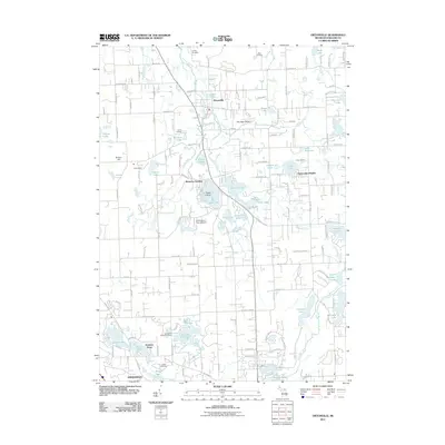
2011 Map of Ortonville
USGS Topo · Published 2011About this map
Ortonville serves as the central hub of this northern Oakland County landscape, where the waters of Kearsley Creek flow through a terrain heavily shaped by glacial activity. The map reveals a dense concentration of kettle lakes and wetlands, including the sprawling reaches of Bald Eagle Lake and Lake Louise. Residential developments like Brandon Gardens and Perry Lake Heights reflect the area's growth as a suburban retreat, yet the presence of several organized camps such as Camp Holiday and Camp Nahelu indicates a long-standing tradition of seasonal recreation. Genealogy researchers will find significant value in the documentation of three distinct burial grounds: Carmer Cemetery in the north, Eaton Cemetery to the east, and Springfield Plains Cemetery near the southern border. The transition from the high elevations at The High Banks and Enders Hill down toward the headwaters of the Clinton River illustrates the complex drainage patterns defining the Springfield area.
Find a feature on this map
145 named features on this map. Tap any name to fly to it.
Don’t see what you’re looking for? This feature index may not catch every label — zoom into the map to look around manually.
Map Details
Editions of this 2011 Ortonville Map
This is the sole edition of this map. No revisions or reprints were ever made.
Other maps of this area

1907 · Pontiac
USGS Topo · 1:62,500

1909 · Milford
USGS Topo · 1:62,500

1920 · Holly
USGS Topo · 1:62,500

1922 · Holly
USGS Topo · 1:62,500

1936 · Highland
USGS Topo · 1:31,680

1936 · Clarkston
USGS Topo · 1:31,680

1936 · Pontiac North
USGS Topo · 1:31,680

1942 · Highland
USGS Topo · 1:24,000

1943 · Holly
USGS Topo · 1:62,500

1943 · Clarkston
USGS Topo · 1:24,000
Featured Places
- Independence Charter Township, MI
- Springfield Charter Township, MI
- Ortonville, MI
- Brandon Gardens, MI
- Jossman Acres, MI