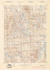
1945 Map of Ortonville
USGS Topo · Published 1945About this map
Ortonville serves as the focal point of this mid-1940s landscape, situated at the junction of Ortonville Rd and Oakwood Rd. The surrounding terrain is defined by a dense concentration of glacial kettle lakes, ranging from the prominent Eagle Lake and Seymour Lake to smaller bodies like Cedar Lake and Mud Lake. Education and community life are well-documented through the placement of rural institutions such as the Union Brandon Sch, Brandon Center Sch, and Oak Hill Sch, alongside the Mt Bethel Ch.
Find a feature on this map
74 named features on this map. Tap any name to fly to it.
Don’t see what you’re looking for? This feature index may not catch every label — zoom into the map to look around manually.
Map Details
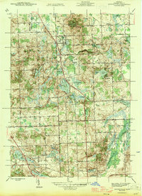
Editions of this 1945 Ortonville Map
2 editions found
Other maps of this area

1907 · Pontiac
USGS Topo · 1:62,500

1909 · Milford
USGS Topo · 1:62,500

1920 · Holly
USGS Topo · 1:62,500

1922 · Holly
USGS Topo · 1:62,500

1936 · Highland
USGS Topo · 1:31,680

1936 · Clarkston
USGS Topo · 1:31,680

1936 · Pontiac North
USGS Topo · 1:31,680

1942 · Highland
USGS Topo · 1:24,000

1943 · Holly
USGS Topo · 1:62,500

1943 · Clarkston
USGS Topo · 1:24,000
Featured Places
- Independence Charter Township, MI
- Springfield Charter Township, MI
- Ortonville, MI
- Brandon Charter Township, MI
- Groveland Township, MI