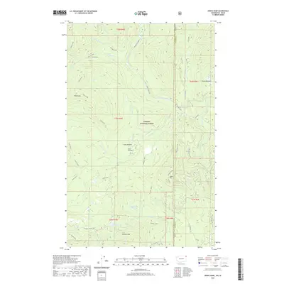
2020 Map of Orwig Hump
USGS Topo · Published 2020About this map
Kaniksu National Forest defines this high-altitude landscape along the border of Idaho and Washington, where the Pend Oreille and Bonner county lines meet. The terrain is characterized by a series of prominent summits, including Orwig Hump, Tillicum Peak, and Diamond Peak, which overlook a network of hydrologic features such as Huff Lake and Petit Lake. The map reveals a sophisticated forest management and access system, indicated by numerous specialized roads like the Nordman Metaline and various National Forest Development routes. High-elevation openings like Sema Meadows and Mountain Meadows interrupt the dense timber, providing distinct landmarks for navigation. This 2020 survey documents the intersection of modern forestry infrastructure with the ancient drainage patterns of Tillicum Creek and the N Fork Granite Cr.
Find a feature on this map
53 named features on this map. Tap any name to fly to it.
Don’t see what you’re looking for? This feature index may not catch every label — zoom into the map to look around manually.
Map Details
Editions of this 2020 Orwig Hump Map
This is the sole edition of this map. No revisions or reprints were ever made.
Other maps of this area

1911 · Priest Lake
USGS Topo · 1:250,000

1913 · Priest Lake
USGS Topo · 1:250,000

1934 · Metaline
USGS Topo · 1:125,000

1942 · Metaline
USGS Topo · 1:125,000

1958 · Sandpoint
USGS Topo · 1:250,000

1963 · Sandpoint
USGS Topo · 1:250,000

1967 · Priest Lake NW
USGS Topo · 1:24,000

1967 · Monumental Mtn.
USGS Topo · 1:24,000

1967 · Helmer Mtn
USGS Topo · 1:24,000

1967 · Pass Creek
USGS Topo · 1:24,000