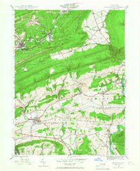
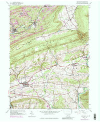
1944 Map of Orwigsburg
USGS Topo · Published 1967About this map
The ridge-and-valley landscape of Schuylkill River valley in the mid-1940s is defined by its deep coal-country roots and the transition between industrial mountain corridors and the agricultural basins of East Brunswick and West Brunswick. Steep terrain at Sharp Mountain and Second Mountain funnels settlement along the water, with the Reading railroad lines serving the anthracite-linked communities of New Philadelphia Silver Creek P O, Middleport, and Brockton.
Find a feature on this map
32 named features on this map. Tap any name to fly to it.
Don’t see what you’re looking for? This feature index may not catch every label — zoom into the map to look around manually.
Map Details
Editions of this 1944 Orwigsburg Map
6 editions found

Other maps of this area

1889 · Hazleton
USGS Topo · 1:62,500

1889 · Pottsville
USGS Topo · 1:62,500

1891 · Hazleton
USGS Topo · 1:62,500

1891 · Pottsville
USGS Topo · 1:62,500

1892 · Mahanoy
USGS Topo · 1:62,500

1893 · Hazleton
USGS Topo · 1:62,500

1893 · Mahanoy
USGS Topo · 1:62,500

1909 · Hamburg
USGS Topo · 1:62,500

1911 · Hamburg
USGS Topo · 1:62,500

1944 · Pottsville
USGS Topo · 1:24,000
Featured Places
- Orwigsburg, PA
- New Philadelphia, PA
- Deer Lake, West Brunswick Township
- Middleport, PA
- North Manheim Township, PA