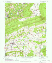
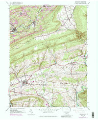
1944 Map of Orwigsburg
USGS Topo · Published 1970About this map
The ridge-and-valley topography of Schuylkill County is clearly defined here by the parallel rises of Sharp Mountain and Second Mountain, which separate the coal-mining regions to the north from the agricultural valleys to the south. In the northern reaches, extensive strip mines surround settlements like Middleport and New Philadelphia, where the Schuylkill River begins its descent through the gap. This industrial landscape contrasts sharply with the southern township of West Brunswick, centered on the borough of Orwigsburg. Here, the land is dotted with local landmarks like the Drive-in Theater and Bethel Ch, alongside small rural schools such as Pinedale Sch. The eastern edge of the map follows the Little Schuylkill River through Drehersville, tracing the path of the Reading railroad as it skirts the base of North Mountain.
Find a feature on this map
41 named features on this map. Tap any name to fly to it.
Don’t see what you’re looking for? This feature index may not catch every label — zoom into the map to look around manually.
Map Details
Editions of this 1944 Orwigsburg Map
6 editions found

Other maps of this area

1889 · Hazleton
USGS Topo · 1:62,500

1889 · Pottsville
USGS Topo · 1:62,500

1891 · Hazleton
USGS Topo · 1:62,500

1891 · Pottsville
USGS Topo · 1:62,500

1892 · Mahanoy
USGS Topo · 1:62,500

1893 · Hazleton
USGS Topo · 1:62,500

1893 · Mahanoy
USGS Topo · 1:62,500

1909 · Hamburg
USGS Topo · 1:62,500

1911 · Hamburg
USGS Topo · 1:62,500

1944 · Pottsville
USGS Topo · 1:24,000
Featured Places
- Orwigsburg, PA
- New Philadelphia, PA
- Deer Lake, West Brunswick Township
- Middleport, PA
- North Manheim Township, PA