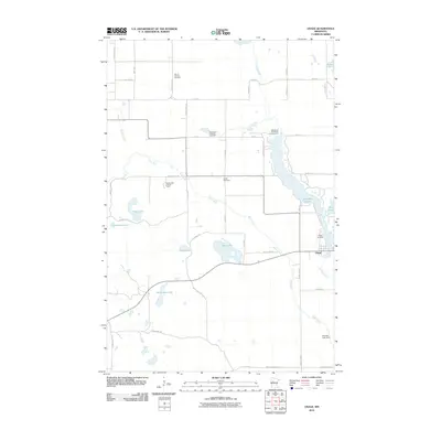
2010 Map of Osage
USGS Topo · Published 2010About this map
The settlement of Osage serves as the focal point for this Becker County landscape, where the Straight River and Shell River converge amidst a dense concentration of glacial lakes. The 2010 geography reveals a well-established network of local heritage sites, including several community burial grounds such as Osage Cemetery, Linnel Cemetery, and Saint Paul's Lutheran Cemetery. A notable navigational landmark, the Smoky Hills Lookout Tower, stands to the west, overlooking a terrain punctuated by water bodies with distinctive names like Bottomless Lake, Elbow Lake, and Mud Lake. The presence of the Straight Lake Dam and the Basswood Bay Resort Campground on the eastern side of the quadrangle suggests the area's dual role in water management and seasonal recreation, while the numerous county highways like County Hwy-47 connect these rural landmarks.
Find a feature on this map
53 named features on this map. Tap any name to fly to it.
Don’t see what you’re looking for? This feature index may not catch every label — zoom into the map to look around manually.
Map Details
Editions of this 2010 Osage Map
This is the sole edition of this map. No revisions or reprints were ever made.
Other maps of this area

1953 · Brainerd
USGS Topo · 1:250,000

1954 · Bemidji
USGS Topo · 1:250,000

1957 · Brainerd
USGS Topo · 1:250,000

1957 · Bemidji
USGS Topo · 1:250,000

1958 · Bemidji
USGS Topo · 1:250,000

1958 · Brainerd
USGS Topo · 1:250,000

1965 · Brainerd
USGS Topo · 1:250,000

1969 · Wolf Lake
USGS Topo · 1:24,000

1969 · Evergreen
USGS Topo · 1:24,000

1969 · Park Rapids SW
USGS Topo · 1:24,000