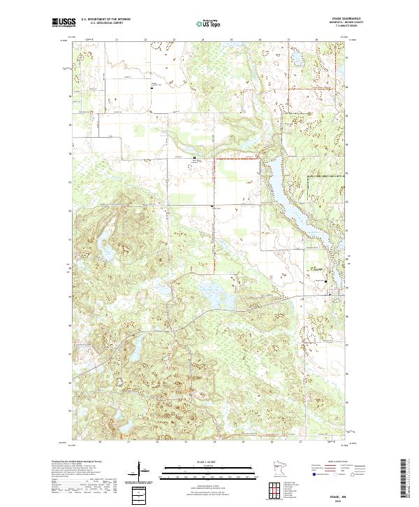
2022 Map of Osage
USGS Topo · Published 2022About this map
Osage sits at a transition between the wetlands and the rising elevation of the Smokey Hills, where the Straight River and Shell River navigate a complex network of glacial lakes. This 2022 survey details a landscape where water and timber define the geography, evidenced by the expansive Smokey Hills State Forest and named water bodies such as Mud Lake and Straight Lake. The settlement pattern is anchored by several distinct burial grounds, including Osage Cem, Mount Calvary Cem, and Saint Paul's Lutheran Cem, reflecting the area's established community roots. The transportation network is a mix of practical county roads and recreational paths, most notably the Forest Riders Trails Trl and the Smokey Hills Trl, which wind through the township boundaries of T140N R36W and T139N R37W.
Find a feature on this map
60 named features on this map. Tap any name to fly to it.
Don’t see what you’re looking for? This feature index may not catch every label — zoom into the map to look around manually.
Map Details
Editions of this 2022 Osage Map
This is the sole edition of this map. No revisions or reprints were ever made.
Other maps of this area

1953 · Brainerd
USGS Topo · 1:250,000

1954 · Bemidji
USGS Topo · 1:250,000

1957 · Brainerd
USGS Topo · 1:250,000

1957 · Bemidji
USGS Topo · 1:250,000

1958 · Bemidji
USGS Topo · 1:250,000

1958 · Brainerd
USGS Topo · 1:250,000

1965 · Brainerd
USGS Topo · 1:250,000

1969 · Wolf Lake
USGS Topo · 1:24,000

1969 · Evergreen
USGS Topo · 1:24,000

1969 · Park Rapids SW
USGS Topo · 1:24,000