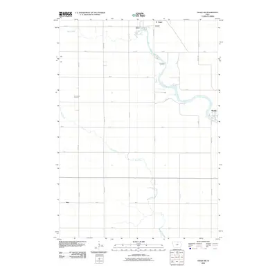
2010 Map of Osage SW
USGS Topo · Published 2010About this map
The Cedar River winds through the heart of this agricultural landscape in Mitchell County, Iowa, defining the local geography around the northern settlement of St Ansgar. To the southeast, the small community of Mitchell occupies a prominent bend in the river, while the tiny hamlet of Dixie sits at a rural crossroads further south. The map reveals a high concentration of historical burial sites tied to early Scandinavian and German heritage, including Blakestad Cemetery, Immanuel Cemetery, and Saint Johns Cemetery, which are scattered along the section lines and high ground near Willow Creek.
Find a feature on this map
28 named features on this map. Tap any name to fly to it.
Don’t see what you’re looking for? This feature index may not catch every label — zoom into the map to look around manually.
Map Details
Editions of this 2010 Osage SW Map
This is the sole edition of this map. No revisions or reprints were ever made.
Other maps of this area

1954 · Mason City
USGS Topo · 1:250,000

1957 · Mason City
USGS Topo · 1:250,000

1958 · Mason City
USGS Topo · 1:250,000

1959 · Mason City
USGS Topo · 1:62,500

1959 · Nora Springs
USGS Topo · 1:24,000

1971 · Orchard
USGS Topo · 1:24,000

1971 · Rudd
USGS Topo · 1:24,000

1972 · Osage
USGS Topo · 1:24,000

1972 · St. Ansgar
USGS Topo · 1:24,000

1972 · Osage SW
USGS Topo · 1:24,000