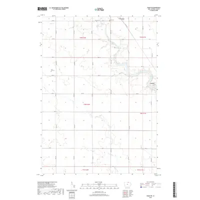
2018 Map of Osage SW
USGS Topo · Published 2018About this map
The Cedar River winds through the eastern portion of this Mitchell County landscape, anchoring the settlements of St. Ansgar and Mitchell. This 2018 survey reveals a rural territory defined by precise section lines and a network of named county roads such as Red Ball Rd and Foothill Ave. The distribution of burial sites, including River View Cem and Saint Johns Cem, reflects the long-standing community foundations of the region. Tributaries like Rock Cr and Willow Cr cross the townships of t99n r18w and t98n r17w, illustrating the drainage patterns that have historically dictated farm placement and land use. For those documenting family history, the map provides clear placement of Immanuel Cem and Blakestad Cem relative to the local section-line road grid.
Find a feature on this map
34 named features on this map. Tap any name to fly to it.
Don’t see what you’re looking for? This feature index may not catch every label — zoom into the map to look around manually.
Map Details
Editions of this 2018 Osage SW Map
This is the sole edition of this map. No revisions or reprints were ever made.
Other maps of this area

1954 · Mason City
USGS Topo · 1:250,000

1957 · Mason City
USGS Topo · 1:250,000

1958 · Mason City
USGS Topo · 1:250,000

1959 · Mason City
USGS Topo · 1:62,500

1959 · Nora Springs
USGS Topo · 1:24,000

1971 · Orchard
USGS Topo · 1:24,000

1971 · Rudd
USGS Topo · 1:24,000

1972 · Osage
USGS Topo · 1:24,000

1972 · St. Ansgar
USGS Topo · 1:24,000

1972 · Osage SW
USGS Topo · 1:24,000