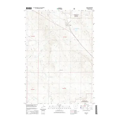
2015 Map of Osage
USGS Topo · Published 2015About this map
The town of Osage serves as a focal point in this high-plains landscape, situated along the corridor of US Highway 16. The area is defined by the expansive Thunder Basin National Grassland, where the drainage network of Beaver Cr, E Fork Beaver Cr, and Turner Cr carves through the terrain. A notable industrial landmark is the Black Hills Power and Light Reservoir, reflecting the intersection of local utility infrastructure and the natural watershed. The map records a complex network of resource-related transportation routes, including Oil City Rd, Baroid Rd, and Clayspur Rd, which signal the region's historical and ongoing ties to bentonite mining and petroleum extraction. Smaller geological features like Benhart Draw and Luce Draw further detail the character of this Weston County quadrangle.
Find a feature on this map
30 named features on this map. Tap any name to fly to it.
Don’t see what you’re looking for? This feature index may not catch every label — zoom into the map to look around manually.
Map Details
Editions of this 2015 Osage Map
This is the sole edition of this map. No revisions or reprints were ever made.
Other maps of this area

1898 · Sundance
USGS Topo · 1:125,000

1899 · Newcastle
USGS Topo · 1:125,000

1901 · Newcastle
USGS Topo · 1:125,000

1902 · Sundance
USGS Topo · 1:125,000

1918 · Moorcroft
USGS Topo · 1:125,000

1951 · Osage SE
USGS Topo · 1:24,000

1954 · Gillette
USGS Topo · 1:250,000

1955 · Newcastle
USGS Topo · 1:250,000

1955 · Gillette
USGS Topo · 1:250,000

1957 · Upton
USGS Topo · 1:62,500