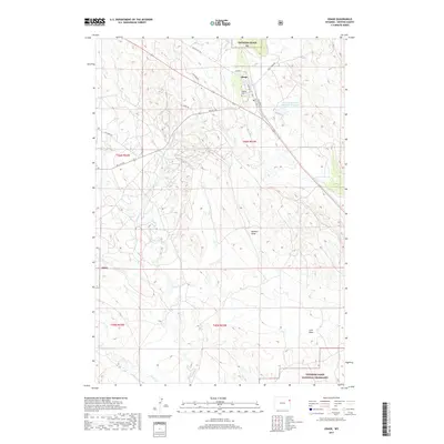
2017 Map of Osage
USGS Topo · Published 2017About this map
Osage anchors the northeastern portion of this survey, a community deeply connected to the industrial infrastructure of Weston County. The town is marked by a network of local streets like Cedar St and Park Ave, and the presence of the Gerhart Cem provides a focal point for local genealogical research. To the east, the Black Hills Power and Light Reservoir indicates the importance of local utility management and water resources in this arid environment. The landscape is defined by extensive drainage systems including Benhart Draw and Luce Draw, which feed into larger watercourses such as Beaver Cr and the E Fork Beaver Cr. Much of the area falls within the protected borders of the Thunder Basin National Grassland, where the interplay between public lands and energy infrastructure is visible through names like Oil City Rd.
Find a feature on this map
27 named features on this map. Tap any name to fly to it.
Don’t see what you’re looking for? This feature index may not catch every label — zoom into the map to look around manually.
Map Details
Editions of this 2017 Osage Map
This is the sole edition of this map. No revisions or reprints were ever made.
Other maps of this area

1898 · Sundance
USGS Topo · 1:125,000

1899 · Newcastle
USGS Topo · 1:125,000

1901 · Newcastle
USGS Topo · 1:125,000

1902 · Sundance
USGS Topo · 1:125,000

1918 · Moorcroft
USGS Topo · 1:125,000

1951 · Osage SE
USGS Topo · 1:24,000

1954 · Gillette
USGS Topo · 1:250,000

1955 · Newcastle
USGS Topo · 1:250,000

1955 · Gillette
USGS Topo · 1:250,000

1957 · Upton
USGS Topo · 1:62,500