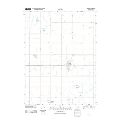
2011 Map of Osceola
USGS Topo · Published 2011About this map
Osceola serves as the central hub of this Polk County landscape, situated where the northern headwaters of Davis Creek begin their course. The town layout is clearly defined, featuring the Osceola Post Office and the Polk County Fair Grounds on its southern edge. This area of Nebraska is characterized by an extensive network of man-made water management features, including the Burritt Reservoir, Mentink Reservoir, and Norman Leach Reservoir to the northwest, and the Rosenquist Reservoir and Anderson Reservoir to the south.
Find a feature on this map
34 named features on this map. Tap any name to fly to it.
Don’t see what you’re looking for? This feature index may not catch every label — zoom into the map to look around manually.
Map Details
Editions of this 2011 Osceola Map
This is the sole edition of this map. No revisions or reprints were ever made.
Other maps of this area

1896 · Stromsburg
USGS Topo · 1:125,000

1899 · David City
USGS Topo · 1:125,000

1955 · Fremont
USGS Topo · 1:250,000

1957 · Fremont
USGS Topo · 1:250,000

1958 · Fremont
USGS Topo · 1:250,000

1958 · Columbus SW
USGS Topo · 1:24,000

1958 · Silver Creek SE
USGS Topo · 1:24,000

1958 · Silver Creek
USGS Topo · 1:24,000
1962 · Swedehome
USGS Topo · 1:24,000
1965 · Stromsburg
USGS Topo · 1:24,000