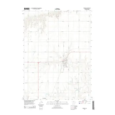
2014 Map of Osceola
USGS Topo · Published 2014About this map
Osceola serves as a central hub in this section of Polk County, where a grid of streets including Central St and Hawkeye St meet the highway corridor of Us-81. The surrounding landscape is defined by the headwaters and drainages of the Big Blue River, which carves through the southern terrain near Stromsburg. This era of the plains is marked by an extensive system of water management, visible in the numerous private and named reservoirs scattered across the section lines, such as Burritt Reservoir in the north and Rosenquist Reservoir to the south.
Find a feature on this map
44 named features on this map. Tap any name to fly to it.
Don’t see what you’re looking for? This feature index may not catch every label — zoom into the map to look around manually.
Map Details
Editions of this 2014 Osceola Map
This is the sole edition of this map. No revisions or reprints were ever made.
Other maps of this area
1896 · Stromsburg
USGS Topo · 1:125,000
1899 · David City
USGS Topo · 1:125,000
1955 · Fremont
USGS Topo · 1:250,000
1957 · Fremont
USGS Topo · 1:250,000
1958 · Fremont
USGS Topo · 1:250,000
1958 · Columbus SW
USGS Topo · 1:24,000
1958 · Silver Creek SE
USGS Topo · 1:24,000
1958 · Silver Creek
USGS Topo · 1:24,000
1962 · Swedehome
USGS Topo · 1:24,000
1965 · Stromsburg
USGS Topo · 1:24,000