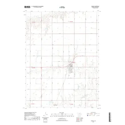
2017 Map of Osceola
USGS Topo · Published 2017About this map
Osceola and the northern outskirts of Stromsburg anchor this survey of Polk County, where the agricultural landscape is defined by a dense grid of section roads and a sophisticated network of private water management. The terrain is notably punctuated by numerous named basins, including Burritt Reservoir, Mentink Reservoir, and Norman Leach Reservoir, illustrating the critical role of water storage for the surrounding farms. In the southeastern portion of the map, the headwaters of the Big Blue River wind through the township, joined by Davis Cr. The town of Osceola is shown in detail, with its residential core organized around streets like Nebraska St and Central St, while the expansive rural sections are partitioned by arterial routes such as Center Rd and 130 Blvd.
Find a feature on this map
46 named features on this map. Tap any name to fly to it.
Don’t see what you’re looking for? This feature index may not catch every label — zoom into the map to look around manually.
Map Details
Editions of this 2017 Osceola Map
This is the sole edition of this map. No revisions or reprints were ever made.
Other maps of this area

1896 · Stromsburg
USGS Topo · 1:125,000

1899 · David City
USGS Topo · 1:125,000

1955 · Fremont
USGS Topo · 1:250,000

1957 · Fremont
USGS Topo · 1:250,000

1958 · Fremont
USGS Topo · 1:250,000

1958 · Columbus SW
USGS Topo · 1:24,000

1958 · Silver Creek SE
USGS Topo · 1:24,000

1958 · Silver Creek
USGS Topo · 1:24,000
1962 · Swedehome
USGS Topo · 1:24,000
1965 · Stromsburg
USGS Topo · 1:24,000