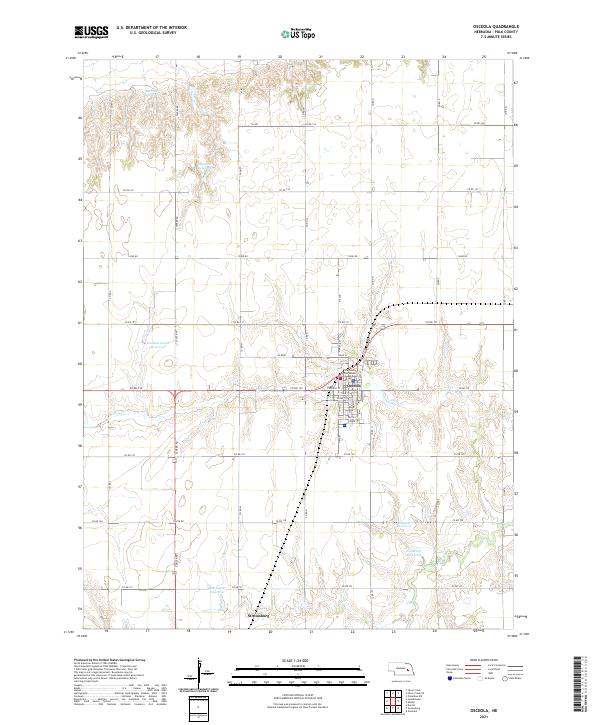
2021 Map of Osceola
USGS Topo · Published 2021About this map
Osceola, the county seat of Polk County, serves as the primary hub of this eastern Nebraska landscape. The grid-based township layout is anchored by the Polk County Courthouse, surrounded by streets such as Main St and Valley St. This modern survey reveals a highly managed hydrological system, where numerous private and public water bodies like Burritt Reservoir and Mentink Reservoir dot the upland plains. These reservoirs, alongside Davis Cr, feed into the larger drainage basin of the Big Blue River at the southern edge of the quadrangle.
Find a feature on this map
46 named features on this map. Tap any name to fly to it.
Don’t see what you’re looking for? This feature index may not catch every label — zoom into the map to look around manually.
Map Details
Editions of this 2021 Osceola Map
This is the sole edition of this map. No revisions or reprints were ever made.
Other maps of this area

1896 · Stromsburg
USGS Topo · 1:125,000

1899 · David City
USGS Topo · 1:125,000

1955 · Fremont
USGS Topo · 1:250,000

1957 · Fremont
USGS Topo · 1:250,000

1958 · Fremont
USGS Topo · 1:250,000

1958 · Columbus SW
USGS Topo · 1:24,000

1958 · Silver Creek SE
USGS Topo · 1:24,000

1958 · Silver Creek
USGS Topo · 1:24,000
1962 · Swedehome
USGS Topo · 1:24,000
1965 · Stromsburg
USGS Topo · 1:24,000