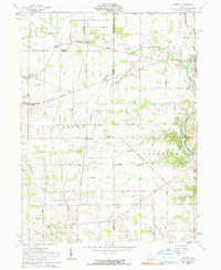
1961 Map of Osgood
USGS Topo · Published 1990About this map
The small rural settlements of Osgood and Yorkshire anchor this 1961 survey of the western Ohio countryside. This landscape is a patchwork of family-named road networks, including Houschilt Road, Stonerock Road, and Pittsenbarger Road, which speak to the deep ancestral roots of the local farming community. The map captures the agricultural and early industrial infrastructure of the era, from the scattered Gravel Pits to the presence of an Oil Well and Gas Well in Patterson township.
Find a feature on this map
58 named features on this map. Tap any name to fly to it.
Don’t see what you’re looking for? This feature index may not catch every label — zoom into the map to look around manually.
Map Details
Editions of this 1961 Osgood Map
3 editions found
Other maps of this area

1908 · St. Henry
USGS Topo · 1:62,500

1909 · Loramie
USGS Topo · 1:62,500

1911 · Loramie
USGS Topo · 1:62,500

1911 · Covington
USGS Topo · 1:62,500

1944 · Covington
USGS Topo · 1:62,500

1944 · Loramie
USGS Topo · 1:62,500

1953 · Muncie
USGS Topo · 1:250,000

1956 · Muncie
USGS Topo · 1:250,000

1961 · Dawn
USGS Topo · 1:24,000
1961 · Piqua West
USGS Topo · 1:24,000