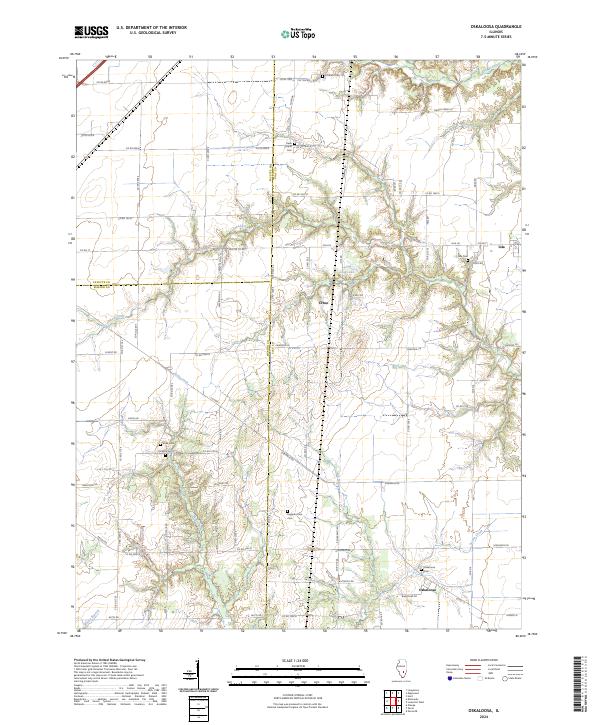
2024 Map of Oskaloosa
USGS Topo · Published 2024About this map
The agrarian landscape of southern Illinois is defined here by the headwaters of Skillet Fork and the winding course of Crooked Creek. This contemporary survey of the rural borderlands where Clay Co, Fayette Co, and Marion Co meet reveals a persistent pattern of small-scale settlement and family-named landmarks. Small communities like Oskaloosa, Iola, and Cruse anchor the grid of township roads. For local historians and genealogists, the map provides precise locations for numerous burial grounds, including the Keen Chapel Cem and Higginbotham Cem, often found at the edge of woodlots or near creek bends like Sutton Creek. The topography is subtly punctuated by the ravines of Dismal Creek and the small basin of Ging Lake, illustrating how the drainage patterns of the Little Wabash River watershed have shaped the placement of farms and cemeteries across these three counties.
Find a feature on this map
79 named features on this map. Tap any name to fly to it.
Don’t see what you’re looking for? This feature index may not catch every label — zoom into the map to look around manually.
Map Details
Editions of this 2024 Oskaloosa Map
This is the sole edition of this map. No revisions or reprints were ever made.
Other maps of this area

1934 · Salem
USGS Topo · 1:62,500

1938 · Salem
USGS Topo · 1:62,500

1945 · Kinmundy
USGS Topo · 1:62,500

1947 · Kinmundy
USGS Topo · 1:62,500

1952 · Xenia
USGS Topo · 1:62,500

1956 · Edgewood
USGS Topo · 1:62,500

1958 · Belleville
USGS Topo · 1:250,000

1962 · Belleville
USGS Topo · 1:250,000
1965 · Omega
USGS Topo · 1:24,000
1968 · Xenia
USGS Topo · 1:24,000