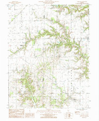
1985 Map of Oskaloosa
USGS Topo · Published 1985About this map
Iola and the surrounding townships of Larkinsburg and Oskaloosa define this rural Illinois landscape in the mid-1980s. The area is characterized by a complex network of watercourses, including the southern flow of the Skillet Fork and the winding path of Dismal Creek in the northeast. The map illustrates the convergence of Clay, Fayette, and Marion counties, highlighting how political boundaries follow the section lines across this agricultural region. Small water bodies like Patterson Lake and Ging Lake are scattered throughout the northern sections, while the drainage patterns of Crooked Creek and Sutton Creek indicate the varied local topography. This provisional survey captures the distribution of rural residences and the road network connecting the primary settlement at Iola to outlying areas like Laclede and Meacham.
Find a feature on this map
15 named features on this map. Tap any name to fly to it.
Don’t see what you’re looking for? This feature index may not catch every label — zoom into the map to look around manually.
Map Details
Editions of this 1985 Oskaloosa Map
This is the sole edition of this map. No revisions or reprints were ever made.
Other maps of this area

1934 · Salem
USGS Topo · 1:62,500

1938 · Salem
USGS Topo · 1:62,500

1945 · Kinmundy
USGS Topo · 1:62,500

1947 · Kinmundy
USGS Topo · 1:62,500

1952 · Xenia
USGS Topo · 1:62,500

1956 · Edgewood
USGS Topo · 1:62,500

1958 · Belleville
USGS Topo · 1:250,000

1962 · Belleville
USGS Topo · 1:250,000
1965 · Omega
USGS Topo · 1:24,000
1968 · Xenia
USGS Topo · 1:24,000