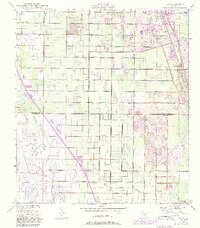
1949 Map of Oslo
USGS Topo · Published 1983About this map
The boundary between Indian River Co and St Lucie Co serves as a central divide in this mid-century coastal survey. Along the eastern shore, the Florida East Coast railway dictates the settlement pattern, connecting the small community of Nevins with the developing residential blocks of Oslo. This era of Florida's Atlantic coast reflects a transition from agricultural drainage projects, evidenced by the South Canal, toward a tourism and recreation-based economy.
Find a feature on this map
13 named features on this map. Tap any name to fly to it.
Don’t see what you’re looking for? This feature index may not catch every label — zoom into the map to look around manually.
Map Details
Editions of this 1949 Oslo Map
3 editions found
Other maps of this area

1948 · Riomar
USGS Topo · 1:24,000

1948 · Indrio
USGS Topo · 1:24,000

1949 · Fort Pierce
USGS Topo · 1:24,000

1949 · Vero Beach
USGS Topo · 1:24,000

1949 · Oslo
USGS Topo · 1:24,000

1949 · Fort Pierce NW
USGS Topo · 1:24,000

1950 · Riomar
USGS Topo · 1:24,000

1950 · Fort Pierce
USGS Topo · 1:24,000

1950 · Fort Pierce NW
USGS Topo · 1:24,000

1950 · Oslo
USGS Topo · 1:24,000