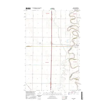
2016 Map of Oslo
USGS Topo · Published 2016About this map
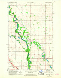
Oslo sits at a sharp oxbow of the Red River of the North, serving as a focal point where the borders of Marshall, Walsh, Polk, and Grand Forks counties converge. This 2016 survey highlights the intricate hydrology of the Red River Valley, where the meandering main channel is fed by the Turtle River and Marais River, alongside an extensive network of engineered drainage like County Ditch Number 13. The settlement of Poland appears to the west, situated within a strictly gridded agricultural landscape defined by roads like Co Hwy 19 and 54th St NE. Local heritage is anchored by the Riverside Cem and Saint Joseph Cem, which stand near the river's edge, reflecting the enduring community footprints in this fertile borderland between Minnesota and North Dakota.
Find a feature on this map
40 named features on this map. Tap any name to fly to it.
Don’t see what you’re looking for? This feature index may not catch every label — zoom into the map to look around manually.
Map Details
Editions of this 2016 Oslo Map
This is the sole edition of this map. No revisions or reprints were ever made.
Other maps of this area

1918 · Acton
USGS Topo · 1:62,500

1926 · Ardoch
USGS Topo · 1:62,500

1943 · Grafton
USGS Topo · 1:62,500

1952 · Thief River Falls
USGS Topo · 1:250,000

1956 · Thief River Falls
USGS Topo · 1:250,000

1957 · Thief River Falls
USGS Topo · 1:250,000
1966 · Oslo NE
USGS Topo · 1:24,000
1966 · Big Woods
USGS Topo · 1:24,000
1966 · Oslo
USGS Topo · 1:24,000
1966 · Oslo SE
USGS Topo · 1:24,000