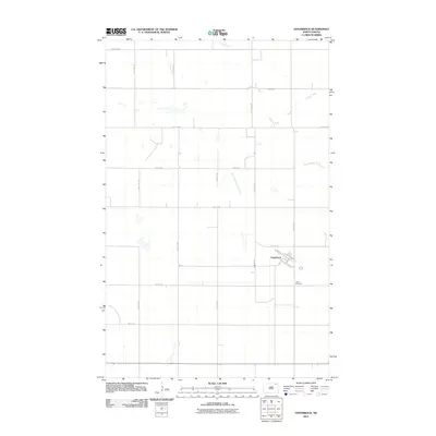
2011 Map of Osnabrock
USGS Topo · Published 2011About this map
Osnabrock serves as the central hub of this agricultural landscape in Cavalier County, where the town plat follows a traditional grid with street names like Broad St and Hereford St. The surrounding countryside is defined by its water systems, including the Tongue River flowing through the northern section and the headwaters of the North Branch Park River and South Branch Park River to the south. These river branches delineate the drainage patterns of the high plains, illustrating how early settlement and road networks, such as Yellow Brick Rd, adapted to the natural contours of the land. Just south of the town center, Union Cemetery provides a primary point of interest for genealogists and local historians, representing generations of families who established this rural community.
Find a feature on this map
23 named features on this map. Tap any name to fly to it.
Don’t see what you’re looking for? This feature index may not catch every label — zoom into the map to look around manually.
Map Details
Editions of this 2011 Osnabrock Map
This is the sole edition of this map. No revisions or reprints were ever made.
Other maps of this area

1953 · Devils Lake
USGS Topo · 1:250,000

1956 · Devils Lake
USGS Topo · 1:250,000

1967 · Langdon East
USGS Topo · 1:24,000

1969 · Olga SW
USGS Topo · 1:24,000

1972 · Osnabrock
USGS Topo · 1:24,000

1972 · Nekoma
USGS Topo · 1:24,000

1972 · Easby
USGS Topo · 1:24,000
1972 · Milton
USGS Topo · 1:24,000

1972 · Osnabrock SW
USGS Topo · 1:24,000
1972 · Olga
USGS Topo · 1:24,000