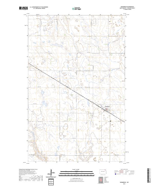
2024 Map of Osnabrock
USGS Topo · Published 2024About this map
The town of Osnabrock serves as the central hub of this prairie landscape in Cavalier County, characterized by a meticulous grid of rural roads and the headwaters of several regional waterways. This corner of North Dakota is defined by the drainage patterns of the Tongue River in the northeast and the diverging paths of the North Branch Park River and South Branch Park River to the south. The township structure is clearly defined through sections T160N R58W and R59W, illustrating the persistent influence of the Public Land Survey System on the modern landscape. Genealogists and local researchers will find the Union Cem situated just south of the main settlement along 116th Ave NE. The street plan of the town itself includes notable thoroughfares such as Broadway, Emerald St, and the distinctively named Yellow Brick Rd.
Find a feature on this map
28 named features on this map. Tap any name to fly to it.
Don’t see what you’re looking for? This feature index may not catch every label — zoom into the map to look around manually.
Map Details
Editions of this 2024 Osnabrock Map
This is the sole edition of this map. No revisions or reprints were ever made.
Other maps of this area

1953 · Devils Lake
USGS Topo · 1:250,000

1956 · Devils Lake
USGS Topo · 1:250,000

1967 · Langdon East
USGS Topo · 1:24,000

1969 · Olga SW
USGS Topo · 1:24,000

1972 · Osnabrock
USGS Topo · 1:24,000

1972 · Nekoma
USGS Topo · 1:24,000

1972 · Easby
USGS Topo · 1:24,000
1972 · Milton
USGS Topo · 1:24,000

1972 · Osnabrock SW
USGS Topo · 1:24,000
1972 · Olga
USGS Topo · 1:24,000