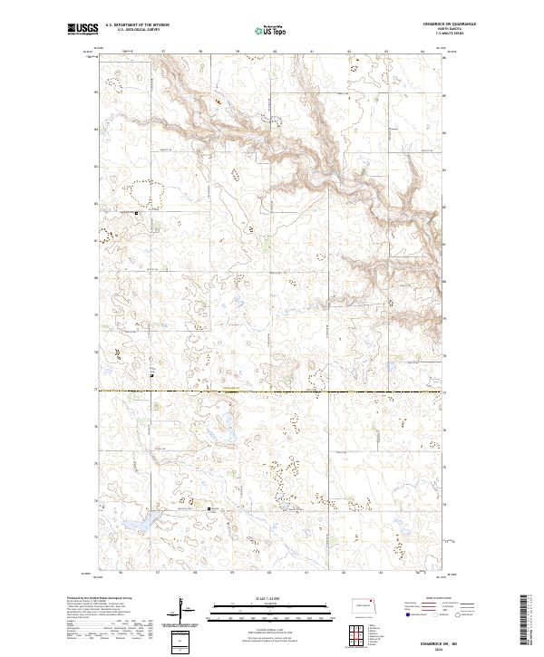
2024 Map of Osnabrock SW
USGS Topo · Published 2024About this map
Cavalier County and Walsh County meet along a rural agricultural grid defined by the South Branch Park River, which carves a deep meandering path across the northern terrain. This corner of North Dakota is characterized by its small, scattered rural burial grounds, including Highland Cem, Soper Cem, and Silvesta Cem, which serve as primary markers of the early families who settled these townships. The landscape is predominantly open and punctuated by numerous seasonal wetlands and small water bodies. In the southwestern section, the Walsh County Waterfowl Production Area preserves a significant portion of this native prairie pothole habitat. A network of section-line roads, such as Co Hwy 22 and the Prairie Trl, connects the isolated farmsteads and agricultural tracts that define the region's economy and layout.
Find a feature on this map
26 named features on this map. Tap any name to fly to it.
Don’t see what you’re looking for? This feature index may not catch every label — zoom into the map to look around manually.
Map Details
Editions of this 2024 Osnabrock SW Map
This is the sole edition of this map. No revisions or reprints were ever made.
Other maps of this area

1953 · Devils Lake
USGS Topo · 1:250,000

1956 · Devils Lake
USGS Topo · 1:250,000

1972 · Osnabrock
USGS Topo · 1:24,000

1972 · Nekoma
USGS Topo · 1:24,000

1972 · Easby
USGS Topo · 1:24,000
1972 · Milton
USGS Topo · 1:24,000

1972 · Osnabrock SW
USGS Topo · 1:24,000

1972 · Adams
USGS Topo · 1:24,000

1972 · Fairdale
USGS Topo · 1:24,000

1972 · Edmore NE
USGS Topo · 1:24,000