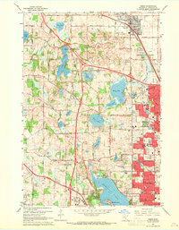
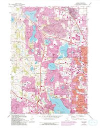
1967 Map of Osseo
USGS Topo · Published 1969About this map
Medicine Lake anchors the southern portion of this landscape, where the growing suburbs of New Hope, Crystal, and Plymouth begin to press against the agricultural and industrial fringe of western Hennepin County. The transition from rural to suburban is evident in the numerous gravel pits scattered across Maple Grove and the burgeoning Minneapolis Industrial Park near the Soo Line tracks. For those tracing family histories, the map identifies several local resting places, including Gethsemane Cemetery, St Marys Cem, and the uniquely named Niggler Cem near Osseo. Educational and religious foundations are well-established, from North Hennepin State College to the Mission Farms complex. The area's water-rich geography is defined by a series of lakes such as Fish Lake, Eagle Lake, and Rice Lake, many of which remain undeveloped during this mid-century period as the regional transportation network of the Great Northern railroad and local thoroughfares like Rockford Road expand.
Find a feature on this map
101 named features on this map. Tap any name to fly to it.
Don’t see what you’re looking for? This feature index may not catch every label — zoom into the map to look around manually.
Map Details
Editions of this 1967 Osseo Map
5 editions found
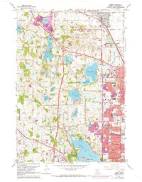
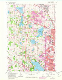
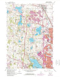
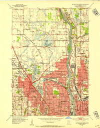
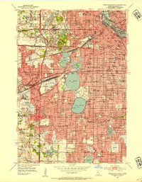
Other maps of this area

1896 · Minneapolis
USGS Topo · 1:62,500

1901 · Minneapolis
USGS Topo · 1:62,500

1902 · Anoka
USGS Topo · 1:62,500

1905 · Minnetonka
USGS Topo · 1:62,500

1907 · Minnetonka
USGS Topo · 1:62,500

1909 · Rockford
USGS Topo · 1:62,500
1952 · Minneapolis North
USGS Topo · 1:24,000
1952 · Minneapolis South
USGS Topo · 1:24,000

1953 · Saint Paul
USGS Topo · 1:250,000

1953 · Stillwater
USGS Topo · 1:250,000