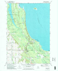
1971 Map of Ossineke
USGS Topo · Published 1974About this map
The coastal settlement of Ossineke sits at the confluence of the North Branch Devils River and Thunder Bay, serving as a gateway to the dense timberlands of the Thunder Bay River State Forest. The landscape is defined by the transition from the low-lying Black River Swamp to the recreational shoreline at Sanborn County Park and Ossineke Forest Campground.
Find a feature on this map
40 named features on this map. Tap any name to fly to it.
Don’t see what you’re looking for? This feature index may not catch every label — zoom into the map to look around manually.
Map Details
Editions of this 1971 Ossineke Map
2 editions found
Other maps of this area

1954 · Tawas City
USGS Topo · 1:250,000

1954 · Alpena
USGS Topo · 1:250,000

1957 · Alpena
USGS Topo · 1:250,000

1958 · Alpena
USGS Topo · 1:250,000

1958 · Tawas City
USGS Topo · 1:250,000

1969 · Alpena
USGS Topo · 1:250,000

1971 · Lake Winyah
USGS Topo · 1:24,000

1971 · Alpena
USGS Topo · 1:24,000

1971 · Spruce
USGS Topo · 1:24,000

1971 · North Point
USGS Topo · 1:24,000