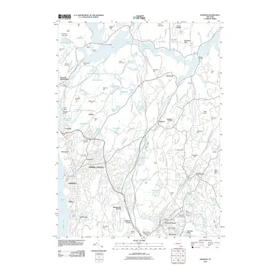
2010 Map of Ossining
USGS Topo · Published 2010About this map
Croton-on-Hudson and the surrounding Westchester County landscape are defined by a complex network of reservoirs and water management infrastructure. The expansive Croton Reservoir dominates the northern portion of the map, held by the New Croton Dam and supported by the Catskill Aqueduct. The area transitions from the riverside density of Ossining and the historic village of Sparta to more suburban and rural developments further inland. Several named peaks like Bald Mountain and Turkey Mountain rise above a high density of small water bodies, including Teatown Lake and Echo Lake.
Find a feature on this map
109 named features on this map. Tap any name to fly to it.
Don’t see what you’re looking for? This feature index may not catch every label — zoom into the map to look around manually.
Map Details
Editions of this 2010 Ossining Map
This is the sole edition of this map. No revisions or reprints were ever made.
Other maps of this area

1892 · Stamford
USGS Topo · 1:62,500

1892 · West Point
USGS Topo · 1:62,500

1892 · Carmel
USGS Topo · 1:62,500

1892 · Tarrytown
USGS Topo · 1:62,500

1893 · Carmel
USGS Topo · 1:62,500

1893 · Stamford
USGS Topo · 1:62,500

1893 · Tarrytown
USGS Topo · 1:62,500

1894 · West Point
USGS Topo · 1:62,500

1894 · Carmel
USGS Topo · 1:62,500

1899 · Stamford
USGS Topo · 1:62,500