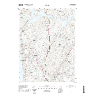
2019 Map of Ossining
USGS Topo · Published 2019About this map
Ossining and the surrounding Westchester County landscape are defined by the massive infrastructure of the New Croton Reservoir and the historic New Croton Aqueduct. In the south, Briarcliff Manor and Pleasantville sit at the intersection of the Saw Mill River Pkwy and Taconic State Pkwy, showcasing a region where early transportation corridors like the Metro-North Railroad shaped suburban development. The map reveals numerous family and community landmarks, including Dale Cem and Saint Augustines Cem, alongside industrial vestiges like Oil Mill Hill and a Quarry near Journeys End Lake. This 2019 survey documents the transition from the densely settled Hudson riverfront at Sparta and Scarborough to the wooded heights of Stayback Hill and Hog Hill, preserving the names of local estates such as Apple Bee Farm and the Kehilath Yakov Rabbinical Seminary.
Find a feature on this map
135 named features on this map. Tap any name to fly to it.
Don’t see what you’re looking for? This feature index may not catch every label — zoom into the map to look around manually.
Map Details
Editions of this 2019 Ossining Map
This is the sole edition of this map. No revisions or reprints were ever made.
Other maps of this area

1892 · Stamford
USGS Topo · 1:62,500

1892 · West Point
USGS Topo · 1:62,500

1892 · Carmel
USGS Topo · 1:62,500

1892 · Tarrytown
USGS Topo · 1:62,500

1893 · Carmel
USGS Topo · 1:62,500

1893 · Stamford
USGS Topo · 1:62,500

1893 · Tarrytown
USGS Topo · 1:62,500

1894 · West Point
USGS Topo · 1:62,500

1894 · Carmel
USGS Topo · 1:62,500

1899 · Stamford
USGS Topo · 1:62,500