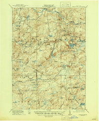
1918 Map of Oswegatchie
USGS Topo · Published 1946About this map
The New York Central and Hudson River RR carves through this northern landscape, connecting industrial outposts like Benson Mines and Jayville during the early twentieth century. This survey records a period of transition where traditional timber and mining operations began to share the wilderness with emerging electrical infrastructure, most notably at the Browns Falls Power Plant and the Maple Hill Dam. The map reveals an intricate network of remote logging and hunting camps, including Streeter Camp and Pattons Camp, scattered across the complex topography of Vrooman Ridge and Blue Mountain. Local educational life is anchored by a system of numbered and named rural schoolhouses, such as the White School and School No 10, serving the small settlements of Fine and Star Lake along the river valleys.
Find a feature on this map
123 named features on this map. Tap any name to fly to it.
Don’t see what you’re looking for? This feature index may not catch every label — zoom into the map to look around manually.
Map Details
Editions of this 1918 Oswegatchie Map
5 editions found

Other maps of this area

1903 · Big Moose
USGS Topo · 1:62,500

1911 · Lowville
USGS Topo · 1:62,500

1912 · Number Four
USGS Topo · 1:62,500

1913 · Lowville
USGS Topo · 1:62,500

1913 · Lake Bonaparte
USGS Topo · 1:62,500

1915 · Gouverneur
USGS Topo · 1:62,500

1915 · Number Four
USGS Topo · 1:62,500

1915 · Russell
USGS Topo · 1:62,500

1916 · Lake Bonaparte
USGS Topo · 1:62,500

1916 · Oswegatchie
USGS Topo · 1:62,500