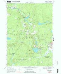
1966 Map of Oswegatchie
USGS Topo · Published 1992About this map
Adirondack State Park encompasses this mid-1960s landscape, where industrial operations and small settlements follow the winding path of the Oswegatchie River. The area is defined by the heavy extraction footprint of Benson Mines and a network of hydropower facilities including the Flat Rock Powerplant and Browns Fall Powerplant. These sites reflect the region's reliance on natural resources, while clusters of social life are found in the community at Star Lake and the smaller hamlets of Oswegatchie and Lower Oswegatchie.
Find a feature on this map
44 named features on this map. Tap any name to fly to it.
Don’t see what you’re looking for? This feature index may not catch every label — zoom into the map to look around manually.
Map Details
Editions of this 1966 Oswegatchie Map
3 editions found
Other maps of this area

1915 · Russell
USGS Topo · 1:62,500

1916 · Oswegatchie
USGS Topo · 1:62,500

1918 · Russell
USGS Topo · 1:62,500

1918 · Oswegatchie
USGS Topo · 1:62,500

1919 · Cranberry Lake
USGS Topo · 1:62,500

1921 · Cranberry Lake
USGS Topo · 1:62,500

1921 · Stark
USGS Topo · 1:62,500

1923 · Stark
USGS Topo · 1:62,500

1931 · Cranberry Lake
USGS Topo · 1:62,500

1940 · Stark
USGS Topo · 1:62,500