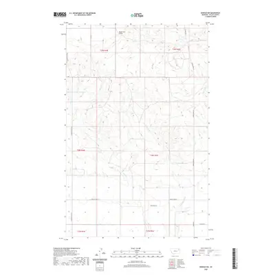
2020 Map of Oswego NW
USGS Topo · Published 2020About this map
Three Buttes dominates the southeastern quadrant of this Valley County landscape, rising above a network of seasonal drainages and prairie roads. This 2020 survey illustrates the remote character of the Frazer District, where the terrain is shaped by the winding paths of Oswego Cr and its tributaries, including the E Fork Oswego Cr. The presence of Structure Number 143 Reservoir in the northwest suggests the vital role of water management in this arid grazing land.
Find a feature on this map
19 named features on this map. Tap any name to fly to it.
Don’t see what you’re looking for? This feature index may not catch every label — zoom into the map to look around manually.
Map Details
Editions of this 2020 Oswego NW Map
This is the sole edition of this map. No revisions or reprints were ever made.
Other maps of this area

1910 · Todd Lakes
USGS Topo · 1:62,500

1915 · Frazer
USGS Topo · 1:62,500

1915 · Oswego
USGS Topo · 1:62,500

1915 · Todd Lakes
USGS Topo · 1:62,500

1915 · Spring Creek
USGS Topo · 1:62,500

1954 · Wolf Point
USGS Topo · 1:250,000

1954 · Glasgow
USGS Topo · 1:250,000

1957 · Glasgow
USGS Topo · 1:250,000

1958 · Wolf Point
USGS Topo · 1:250,000

1958 · Glasgow
USGS Topo · 1:250,000