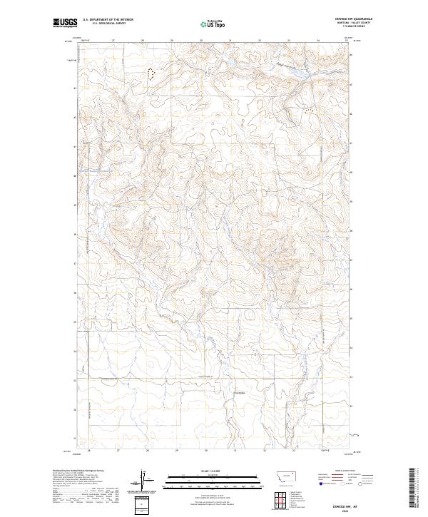
2024 Map of Oswego NW
USGS Topo · Published 2024About this map
Three Buttes dominates the southern landscape of this Valley County quadrangle, where the drainages of the Missouri River basin shape the high plains. The terrain is defined by a network of intermittent waterways and technical water management features like Structure Number 143 Reservoir. To the north, the winding Badger Hole Coulee cuts through the elevations, while the confluence of Oswego Creek and East Fork Oswego Creek provides a natural corridor through the central sections.
Find a feature on this map
18 named features on this map. Tap any name to fly to it.
Don’t see what you’re looking for? This feature index may not catch every label — zoom into the map to look around manually.
Map Details
Editions of this 2024 Oswego NW Map
This is the sole edition of this map. No revisions or reprints were ever made.
Other maps of this area
1910 · Todd Lakes
USGS Topo · 1:62,500
1915 · Frazer
USGS Topo · 1:62,500
1915 · Oswego
USGS Topo · 1:62,500
1915 · Todd Lakes
USGS Topo · 1:62,500
1915 · Spring Creek
USGS Topo · 1:62,500
1954 · Wolf Point
USGS Topo · 1:250,000

1954 · Glasgow
USGS Topo · 1:250,000

1957 · Glasgow
USGS Topo · 1:250,000
1958 · Wolf Point
USGS Topo · 1:250,000

1958 · Glasgow
USGS Topo · 1:250,000