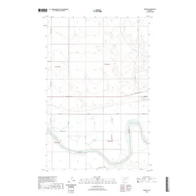
2020 Map of Oswego
USGS Topo · Published 2020About this map
Oswego sits at a geographic crossroads in northeastern Montana, where the local road network meets the winding course of the Missouri River. This landscape is defined by the sharp transition between the upland prairie and the river's riparian corridor, which marks the boundary between Valley and McCone counties. The settlement itself is organized around a small grid of streets including A St, C St, and D St, positioned just north of the Indian Hwy. The terrain is drained by Oswego Cr and its tributary, E Fork Oswego Cr, which cut through the northern sections of the map. Transport and access are central themes, with the Lewis and Clark Trl and State Hwy 528 providing primary transit through the river valley, supported by a network of rural routes like Frazer-Richland Rd and Fourstar Rd.
Find a feature on this map
25 named features on this map. Tap any name to fly to it.
Don’t see what you’re looking for? This feature index may not catch every label — zoom into the map to look around manually.
Map Details
Editions of this 2020 Oswego Map
This is the sole edition of this map. No revisions or reprints were ever made.
Other maps of this area

1915 · Frazer
USGS Topo · 1:62,500

1915 · Oswego
USGS Topo · 1:62,500

1954 · Jordan
USGS Topo · 1:250,000

1954 · Glendive
USGS Topo · 1:250,000

1954 · Wolf Point
USGS Topo · 1:250,000

1954 · Glasgow
USGS Topo · 1:250,000

1956 · Jordan
USGS Topo · 1:250,000

1957 · Glasgow
USGS Topo · 1:250,000

1957 · Glendive
USGS Topo · 1:250,000

1958 · Wolf Point
USGS Topo · 1:250,000