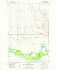
1972 Map of Oswego
USGS Topo · Published 1976About this map
The Missouri River forms a sweeping oxbow in the southern portion of this landscape, marking the transition between Valley Co McCone Co. This 1970s survey illustrates a region defined by agricultural irrigation and heavy rail transit, where the Burlington Northern railroad runs parallel to the Main Canal and several gravel extraction sites. The small settlement of Oswego is the primary community hub, situated north of the river and south of the rolling drainage of Oswego Creek. Evidence of local history and infrastructure includes a Cem near the townsite and the Santee area, while the Fort Peck Indian Reservation Boundary cuts across the southern riverbanks. Numerous springs and wells throughout the northern hills indicate the importance of water management in this high-plains environment, as seen in the development of the Range LB and Range RB land markers.
Find a feature on this map
22 named features on this map. Tap any name to fly to it.
Don’t see what you’re looking for? This feature index may not catch every label — zoom into the map to look around manually.
Map Details
Editions of this 1972 Oswego Map
This is the sole edition of this map. No revisions or reprints were ever made.
Other maps of this area

1915 · Frazer
USGS Topo · 1:62,500

1915 · Oswego
USGS Topo · 1:62,500

1954 · Jordan
USGS Topo · 1:250,000

1954 · Glendive
USGS Topo · 1:250,000

1954 · Wolf Point
USGS Topo · 1:250,000

1954 · Glasgow
USGS Topo · 1:250,000

1956 · Jordan
USGS Topo · 1:250,000

1957 · Glasgow
USGS Topo · 1:250,000

1957 · Glendive
USGS Topo · 1:250,000

1958 · Wolf Point
USGS Topo · 1:250,000