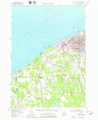
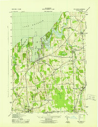
1954 Map of Oswego West
USGS Topo · Published 1970About this map
Fort Ontario guards the mouth of the Oswego River where it enters Lake Ontario, anchoring a mid-century cityscape defined by educational and social institutions. The shoreline stretch of Oswego Beach and Burt Point leads toward the State Teachers College and Oswego Childrens Home, while the interior reveals a network of rural schools and family-named hills. Inland from the city of Oswego, the landscape transitions to agricultural pockets like Fruit Valley and Furniss, interspersed with landmarks such as Saint Marys Chapel and the Irish Settlement. This 1954 topographic survey, compiled from 1942 aerial photography, documents the post-war layout of the region, from the industrial Power House and Sewage Disposal sites to the quiet marshes of Snake Swamp. Significant local history is preserved in the locations of Union Village Rural Cem and numerous district schools, including School No 9 and School No 13, which served the outlying farm communities of the lakefront.
Find a feature on this map
68 named features on this map. Tap any name to fly to it.
Don’t see what you’re looking for? This feature index may not catch every label — zoom into the map to look around manually.
Map Details
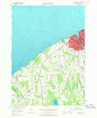
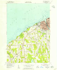
Editions of this 1954 Oswego West Map
4 editions found

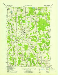
Other maps of this area

1900 · Oswego
USGS Topo · 1:62,500

1900 · Fulton
USGS Topo · 1:62,500

1943 · Oswego East
USGS Topo · 1:31,680

1943 · Oswego West
USGS Topo · 1:31,680
1943 · Hannibal
USGS Topo · 1:31,680

1943 · West Of Texas
USGS Topo · 1:31,680
1943 · Fair Haven
USGS Topo · 1:31,680

1943 · West Ninemile Point
USGS Topo · 1:31,680
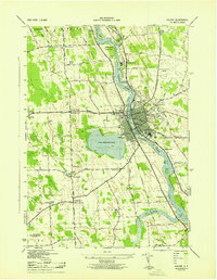
1943 · Fulton
USGS Topo · 1:31,680
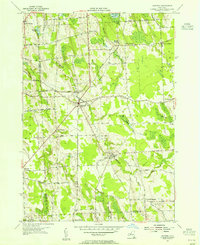
1954 · Hannibal
USGS Topo · 1:24,000