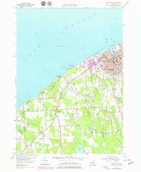
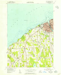
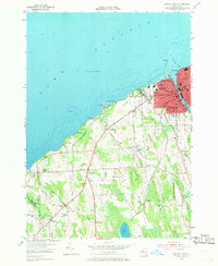
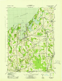
1954 Map of Oswego West
USGS Topo · Published 1978About this map
Lake Ontario borders the shoreline where the Oswego River meets the historic defenses of Fort Ontario. This 1954 survey, updated with 1976 aerial data, captures the post-war expansion of the State University College at Oswego and the urban growth of Oswego. Away from the harbor, the landscape transitions into a series of small agricultural and residential nodes such as Fruit Valley and Oswego Center.
Find a feature on this map
69 named features on this map. Tap any name to fly to it.
Don’t see what you’re looking for? This feature index may not catch every label — zoom into the map to look around manually.
Map Details
Editions of this 1954 Oswego West Map
4 editions found

Other maps of this area

1900 · Oswego
USGS Topo · 1:62,500

1900 · Fulton
USGS Topo · 1:62,500

1943 · Oswego East
USGS Topo · 1:31,680

1943 · Oswego West
USGS Topo · 1:31,680
1943 · Hannibal
USGS Topo · 1:31,680

1943 · West Of Texas
USGS Topo · 1:31,680
1943 · Fair Haven
USGS Topo · 1:31,680

1943 · West Ninemile Point
USGS Topo · 1:31,680
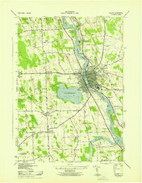
1943 · Fulton
USGS Topo · 1:31,680
1954 · Hannibal
USGS Topo · 1:24,000