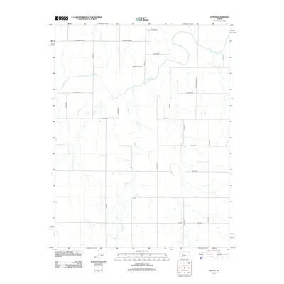
2012 Map of Otis NE
USGS Topo · Published 2012About this map
Smoky Hill River meanders through this agricultural landscape in Ellis County, defining the drainage patterns of the Central Plains during the early 21st century. The map reveals a highly structured grid of section lines and township roads that organize the rural space, though the watercourses of Eagle Cr and Duck Cr provide a natural contrast to the geometric precision of the land divisions. For family historians and genealogists, the placement of Pleasantdale Cem south of S Coline Rd serves as a significant local landmark. The naming conventions of the regional thoroughfares, such as Chetolah Gold Rd and Gorham Galatia Rd, hint at the historic connections between neighboring prairie settlements and the local geography of the Smoky Hill region.
Find a feature on this map
27 named features on this map. Tap any name to fly to it.
Don’t see what you’re looking for? This feature index may not catch every label — zoom into the map to look around manually.
Map Details
Editions of this 2012 Otis NE Map
This is the sole edition of this map. No revisions or reprints were ever made.
Other maps of this area

1896 · Russell
USGS Topo · 1:125,000

1896 · Hays
USGS Topo · 1:125,000

1955 · Great Bend
USGS Topo · 1:250,000

1957 · Great Bend
USGS Topo · 1:250,000

1958 · Great Bend
USGS Topo · 1:250,000
1961 · Walker
USGS Topo · 1:24,000

1961 · Russell SW
USGS Topo · 1:24,000

1961 · Victoria
USGS Topo · 1:24,000
1965 · Otis
USGS Topo · 1:24,000
1966 · Bison
USGS Topo · 1:24,000