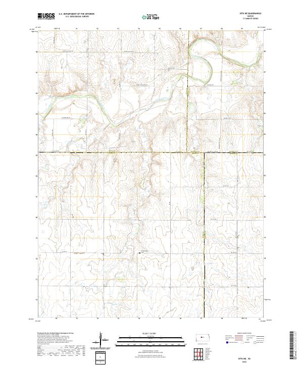
2022 Map of Otis NE
USGS Topo · Published 2022About this map
Smoky Hill River winds across the northern landscape of this Kansas quadrangle, where the borders of Rush, Ellis, Russell, and Barton counties converge. The terrain is defined by the drainage patterns of Duck Cr and Eagle Cr, which carve through the plains toward the main river valley. This rural expanse is crisscrossed by a grid of country roads, including the intriguingly named Chetolah Gold Rd and Schoenchen Rd, reflecting the settlement patterns of the High Plains. A primary focal point for local history is the Pleasantdale Cem, situated centrally within the township boundaries of T16S R16W. The map captures the intersection of several historic townships, documenting the persistent agricultural land use and the specific section-line road network that has organized this portion of the Kansas interior for generations.
Find a feature on this map
26 named features on this map. Tap any name to fly to it.
Don’t see what you’re looking for? This feature index may not catch every label — zoom into the map to look around manually.
Map Details
Editions of this 2022 Otis NE Map
This is the sole edition of this map. No revisions or reprints were ever made.
Other maps of this area

1896 · Russell
USGS Topo · 1:125,000

1896 · Hays
USGS Topo · 1:125,000

1955 · Great Bend
USGS Topo · 1:250,000

1957 · Great Bend
USGS Topo · 1:250,000

1958 · Great Bend
USGS Topo · 1:250,000
1961 · Walker
USGS Topo · 1:24,000

1961 · Russell SW
USGS Topo · 1:24,000

1961 · Victoria
USGS Topo · 1:24,000
1965 · Otis
USGS Topo · 1:24,000
1966 · Bison
USGS Topo · 1:24,000