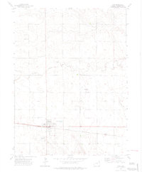
1972 Map of Otis
USGS Topo · Published 1975About this map
Otis serves as the primary hub of this High Plains landscape, situated along the Burlington Northern railroad in Washington County. In the early 1970s, the town structure is clearly defined by its street grid, featuring a Park, a local Cem, and the High Sch. The surrounding terrain is marked by the subtle drainage of Surveyor Creek and several specialized infrastructure points, including a Pumping Station and a Substa east of town.
Find a feature on this map
18 named features on this map. Tap any name to fly to it.
Don’t see what you’re looking for? This feature index may not catch every label — zoom into the map to look around manually.
Map Details
Editions of this 1972 Otis Map
3 editions found
Other maps of this area

1954 · Sterling
USGS Topo · 1:250,000

1958 · Sterling
USGS Topo · 1:250,000

1972 · Otis
USGS Topo · 1:24,000

1972 · Hyde
USGS Topo · 1:24,000

1972 · Lone Star
USGS Topo · 1:24,000

1972 · Snyder Lake
USGS Topo · 1:24,000

1972 · Otis SE
USGS Topo · 1:24,000

1972 · Burdett
USGS Topo · 1:24,000

1973 · Platner
USGS Topo · 1:24,000

1973 · Buffalo Springs Ranch SE
USGS Topo · 1:24,000