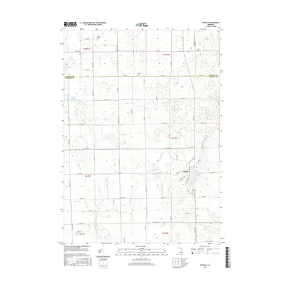
2017 Map of Otisville
USGS Topo · Published 2017About this map
The village of Otisville serves as the central hub of this Genesee County landscape, situated where the terrain transitions into a dense network of agricultural drains and creeks. Local genealogy is well-represented by several burial grounds, including Smith Hill Cem near the village and Hopkins Cem further north along the N Co Line. The landscape is characterized by its glacial hydrology, featuring numerous named water bodies such as McGormick Lake, Burroughs Lake, and Mud Lake. These natural features are intertwined with an extensive drainage system, including the Parker Scothan Drain and Cole Drain, reflecting a long history of water management to support local farming. To the north in Tuscola County, Grass Roots Airport sits as a notable local landmark amidst the sections of t10n r8e.
Find a feature on this map
45 named features on this map. Tap any name to fly to it.
Don’t see what you’re looking for? This feature index may not catch every label — zoom into the map to look around manually.
Map Details
Editions of this 2017 Otisville Map
This is the sole edition of this map. No revisions or reprints were ever made.
Other maps of this area

1920 · Flint
USGS Topo · 1:62,500

1922 · Flint
USGS Topo · 1:62,500

1943 · Flint
USGS Topo · 1:62,500

1954 · Flint
USGS Topo · 1:250,000

1958 · Flint
USGS Topo · 1:250,000

1963 · Columbiaville
USGS Topo · 1:24,000

1963 · Frankenmuth
USGS Topo · 1:24,000

1963 · Elba
USGS Topo · 1:24,000

1963 · Vassar
USGS Topo · 1:24,000

1963 · Juniata
USGS Topo · 1:24,000