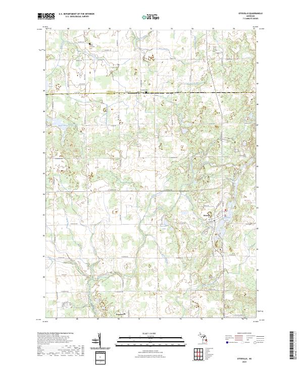
2023 Map of Otisville
USGS Topo · Published 2023About this map
Otisville serves as the primary hub of this landscape, situated at the edge of McCormick Lake where local roads like Center St and Athletic St converge. The terrain is defined by an intricate drainage system including the Thetford and Arbela Drain, Butternut Creek, and Barden Branch, reflecting the agricultural character of the region. This 2023 survey illustrates the modern layout of the Genesee and Tuscola county line, where large parcels and rural residential pockets predominate.
Find a feature on this map
75 named features on this map. Tap any name to fly to it.
Don’t see what you’re looking for? This feature index may not catch every label — zoom into the map to look around manually.
Map Details
Editions of this 2023 Otisville Map
This is the sole edition of this map. No revisions or reprints were ever made.
Other maps of this area

1920 · Flint
USGS Topo · 1:62,500

1922 · Flint
USGS Topo · 1:62,500

1943 · Flint
USGS Topo · 1:62,500

1954 · Flint
USGS Topo · 1:250,000

1958 · Flint
USGS Topo · 1:250,000

1963 · Columbiaville
USGS Topo · 1:24,000

1963 · Frankenmuth
USGS Topo · 1:24,000

1963 · Elba
USGS Topo · 1:24,000

1963 · Vassar
USGS Topo · 1:24,000

1963 · Juniata
USGS Topo · 1:24,000
Featured Places
- Otisville, MI
- Forest Township, MI
- Genesee Charter Township, MI
- Richfield Township, MI
- Thetford Township, MI