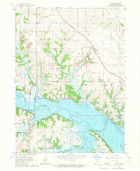
1965 Map of Otley
USGS Topo · Published 1966About this map
The Red Rock Lake reservoir dominates this mid-1960s landscape, having fundamentally altered the course of the Des Moines River through central Marion County. This era of transition is clearly visible, with areas marked for controlled inundation surrounding prominent terrain features like Elk Rock. To the north, the settlement of Otley remains a focal point of commerce and community, served by the Chicago Rock Island and Pacific railroad and the Pella Community Sch. Local industrial history is preserved through the marking of a Strip Mine and an Old Railroad Grade that winds through the hills. Genealogists will find a wealth of family and community history in the numerous burial grounds scattered across the townships, including Price Cem, Karr Cem, and the Coal Ridge Cem near the Coal Ridge Ch.
Find a feature on this map
28 named features on this map. Tap any name to fly to it.
Don’t see what you’re looking for? This feature index may not catch every label — zoom into the map to look around manually.
Map Details
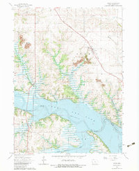
Editions of this 1965 Otley Map
2 editions found
Other maps of this area

1909 · Knoxville
USGS Topo · 1:62,500

1910 · Pella
USGS Topo · 1:62,500

1912 · Knoxville
USGS Topo · 1:62,500

1912 · Pella
USGS Topo · 1:62,500

1954 · Des Moines
USGS Topo · 1:250,000

1956 · Des Moines
USGS Topo · 1:250,000

1957 · Des Moines
USGS Topo · 1:250,000

1965 · Prairie City
USGS Topo · 1:24,000

1965 · Knoxville NW
USGS Topo · 1:24,000

1965 · Monroe
USGS Topo · 1:24,000