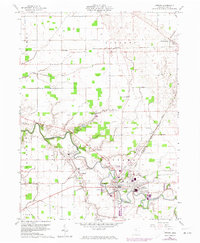
1960 Map of Ottawa
USGS Topo · Published 1974About this map
The Blanchard River meanders through this Putnam County landscape, defining the character of Ottawa and its surrounding townships. The town of Glandorf sits at the confluence where Cranberry Creek meets the river, while the Old Indian Treaty Boundary slices diagonally across the terrain, a silent witness to the area's early 19th-century history. Transportation corridors are central to this mid-century view, with the Baltimore and Ohio and Detroit Toledo and Ironton railroads converging in the heart of the county seat.
Find a feature on this map
37 named features on this map. Tap any name to fly to it.
Don’t see what you’re looking for? This feature index may not catch every label — zoom into the map to look around manually.
Map Details
Editions of this 1960 Ottawa Map
3 editions found

Other maps of this area

1906 · Columbus Grove
USGS Topo · 1:62,500

1907 · Bluffton
USGS Topo · 1:62,500

1908 · Columbus Grove
USGS Topo · 1:62,500

1908 · Ottawa
USGS Topo · 1:62,500

1950 · Marion
USGS Topo · 1:250,000

1953 · Fort Wayne
USGS Topo · 1:250,000

1953 · Muncie
USGS Topo · 1:250,000

1956 · Muncie
USGS Topo · 1:250,000

1956 · Fort Wayne
USGS Topo · 1:250,000

1956 · Toledo
USGS Topo · 1:250,000