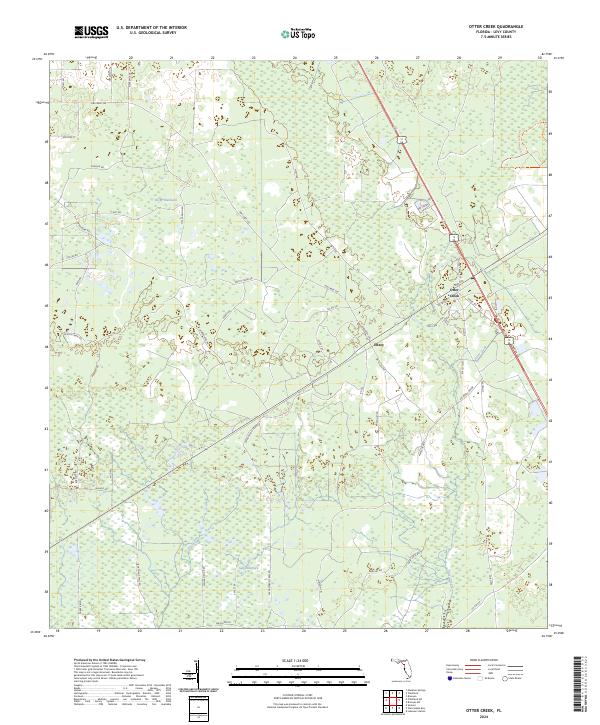
2024 Map of Otter Creek
USGS Topo · Published 2024About this map
Gulf Hammock and Rocky Hammock define this pocket of Levy County, where the low-lying landscape transitions between dense hammocks and the water systems of Rocky Creek and Rocky Run. The settlement of Otter Creek serves as a local crossroads, situated near the headwaters of its namesake Otter Creek. Further west, the small community of Ellzey sits along the roadway network, surrounded by a grid of rural routes and specialized thoroughfares like SW Davidson Tram Rd, which likely reflects the region's historical timber and tram road legacy.
Find a feature on this map
58 named features on this map. Tap any name to fly to it.
Don’t see what you’re looking for? This feature index may not catch every label — zoom into the map to look around manually.
Map Details
Editions of this 2024 Otter Creek Map
This is the sole edition of this map. No revisions or reprints were ever made.
Other maps of this area

1954 · Chiefland
USGS Topo · 1:24,000

1954 · Otter Creek
USGS Topo · 1:24,000

1954 · Bronson
USGS Topo · 1:24,000

1954 · Manatee Springs
USGS Topo · 1:24,000

1954 · Chiefland SW
USGS Topo · 1:24,000

1954 · Bronson SW
USGS Topo · 1:24,000

1954 · Gainesville
USGS Topo · 1:250,000

1955 · Lebanon Station
USGS Topo · 1:24,000

1955 · Waccasassa Bay
USGS Topo · 1:24,000

1955 · Sumner
USGS Topo · 1:24,000