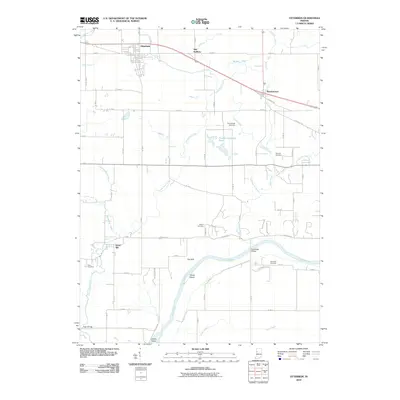
2010 Map of Otterbein
USGS Topo · Published 2010About this map
The Wabash River carves through the southern portion of this landscape, creating a distinct topographical boundary south of The Hills. This area is defined by a dense network of agricultural drainage systems, including Harrington Ditch, Otterbein Ditch, and Moore Ditch, which support the fertile plains surrounding Otterbein. To the east, the settlement of Montmorenci sits near the headwaters of Little Pine Creek, while Green Hill overlooks the river valley to the southwest.
Find a feature on this map
75 named features on this map. Tap any name to fly to it.
Don’t see what you’re looking for? This feature index may not catch every label — zoom into the map to look around manually.
Map Details
Editions of this 2010 Otterbein Map
This is the sole edition of this map. No revisions or reprints were ever made.
Other maps of this area

1941 · Lafayette
USGS Topo · 1:24,000

1942 · Otterbein
USGS Topo · 1:24,000

1942 · Lafayette
USGS Topo · 1:24,000

1950 · Lafayette
USGS Topo · 1:24,000

1951 · Otterbein
USGS Topo · 1:24,000

1953 · Danville
USGS Topo · 1:250,000

1955 · Danville
USGS Topo · 1:250,000

1956 · Danville
USGS Topo · 1:250,000

1961 · Chatterton
USGS Topo · 1:24,000

1961 · Romney
USGS Topo · 1:24,000