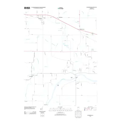
2013 Map of Otterbein
USGS Topo · Published 2013About this map
The town of Otterbein anchors the northern portion of this landscape, where the flat agricultural terrain is crisscrossed by an extensive network of drainage features such as Otterbein Ditch, McFarland Ditch, and Moore Ditch. This 2013 survey illustrates the modern road network radiating from the town, including Old US Hwy 52 and the Jackson Hwy. To the south, the terrain shifts as it approaches the Wabash River, which is defined by riverine features like Goose Island and Colliers Island. Historical crossings are evidenced by the presence of Granville Bridge and Grandville Bridge over Indian Creek, while the small settlement of Green Hill sits near the western edge. Notable for local interest is the Purdue University Pond situated between the primary settlements, and the quiet hamlet of Montmorenci which serves as a junction for local transit in the eastern section of the quadrangle.
Find a feature on this map
63 named features on this map. Tap any name to fly to it.
Don’t see what you’re looking for? This feature index may not catch every label — zoom into the map to look around manually.
Map Details
Editions of this 2013 Otterbein Map
This is the sole edition of this map. No revisions or reprints were ever made.
Other maps of this area

1941 · Lafayette
USGS Topo · 1:24,000

1942 · Otterbein
USGS Topo · 1:24,000

1942 · Lafayette
USGS Topo · 1:24,000

1950 · Lafayette
USGS Topo · 1:24,000

1951 · Otterbein
USGS Topo · 1:24,000

1953 · Danville
USGS Topo · 1:250,000

1955 · Danville
USGS Topo · 1:250,000

1956 · Danville
USGS Topo · 1:250,000

1961 · Chatterton
USGS Topo · 1:24,000

1961 · Romney
USGS Topo · 1:24,000