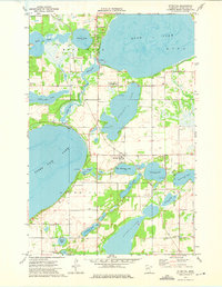
1973 Map of Ottertail
USGS Topo · Published 1975About this map
Ottertail serves as the central hub of this lakeside landscape, positioned where the Soo Line railroad cuts through the heavy concentration of glacial basins. The settlement's infrastructure is closely tied to the surrounding water, with numerous Boat Ramps providing access to major bodies like Otter Tail Lake and Rush Lake. A notable stretch of the Otter Tail River meanders between Mud Lake and Long Lake, showing the intricate drainage patterns that define this part of the county.
Find a feature on this map
33 named features on this map. Tap any name to fly to it.
Don’t see what you’re looking for? This feature index may not catch every label — zoom into the map to look around manually.
Map Details
Editions of this 1973 Ottertail Map
This is the sole edition of this map. No revisions or reprints were ever made.
Other maps of this area

1912 · Battle Lake
USGS Topo · 1:62,500

1914 · Battle Lake
USGS Topo · 1:62,500

1915 · Perham
USGS Topo · 1:62,500

1953 · Brainerd
USGS Topo · 1:250,000

1957 · Brainerd
USGS Topo · 1:250,000

1958 · Brainerd
USGS Topo · 1:250,000

1965 · Brainerd
USGS Topo · 1:250,000

1969 · Henning
USGS Topo · 1:24,000

1969 · Heinola
USGS Topo · 1:24,000

1969 · New York Mills West
USGS Topo · 1:24,000